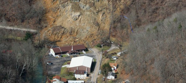
In my previous entry regarding the Yeager airport landslide where I hypothesize for a possible shear zone somewhere near the foundation, I got some interesting comments from fellow engineers. In this entry I would like to clarify some issues.
The hypothesis made about a shear zone was based on published information regarding intercalation of sandstone and shale and photograph observations of the area. A possible dormant landslide was hypothesized by other contributors in the ASCE group in LinkedIn. The model I presented was very simplified in order to test the possibility of the shear surface hypothesis. I will come back to the model with some more details, but I wouldn’t like to deviate from the failure discussion to a model discussion.
I stated previously that usually failures of such large magnitude are more complex and significant data and observations are required to understand the real mechanism. This I am sure will be dealt with by enquiry committees, forensic consultants etc.
I based my hypothesis considering that the Designers of the reinforced earth had done a good job, that the materials used were of appropriate quality and that something outside the structure was responsible or partially responsible for this failure. Many have commented regarding the reinforcement design and all are valuable comments which I will not reply but can be found here. Before a detail analysis and modeling of the failure is possible, additional hard data are required, such as shear strength properties of the actual soil, current tensile strength of the geogrid (as found in the landslide area), excavation at the toe of the slope etc. Until such data become available, only hypothesis can be made that may be completely wrong in the end.
The reason why I made the hypothesis of a shear zone is because it is based on previous information about older landslides in the area, because shale is notoriously tricky material when combined with sandstone and to broaden the possibilities of failure outside the earth structure.
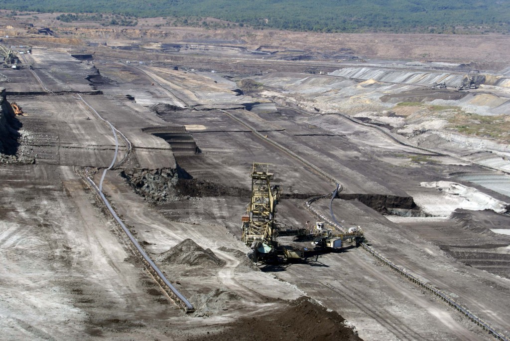
Many times, failures are formed due to very thin weak layers which are very difficult to identify during ground investigation. Sometimes zones (or layers) of a couple of centimeters can be responsible for extended failures. Such zones many times are ignored, especially in very large structures. Consider a borehole of 50-100m with a low strength shale zone of a couple of centimeters, is it always possible to identify it? Even if not ignored, during investigation, a shale zone could appear strong and competent. In the following photograph a translational failure on a lignite mine can be observed. The failure took place on a clayey shale layer of couple of centimeters in a nearly horizontal stratification material. Observe the magnitude of the failure in relation to the huge bucket wheel excavators. Also observe the horizontal movement based on the misalignment of the conveyor belts. The slope inclinations before failure were very shallow, around 1:3 (V:H).

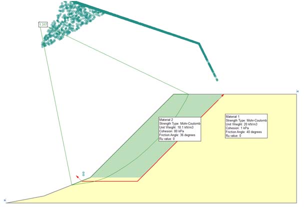
Coming to the slope stability model I used, it was only to validate the possibility of such a failure and not to model the actual reinforced earth slope and its failure. The parameters used were the ones provided by the Lostumbo 2010 presentation and instead of including the reinforcement, a cohesion was used to produce a factor of safety above 1.3 for a circular shear surface inside the soil reinforced structure. A shear surface was not included and a factor of safety above 1.3 was selected because it is assumed that the structure would have been designed above this FS. It is not the intention to assume a soil material with such cohesion. The initial calculation to validate the stability of the model before the failure surface is presented in the following figure.

But once again I hope the discussion will not deviate from the actual issue and get focused on the model. As R. Peck very elegantly noted “stability analyses are tools for the guidance of the investigator. They have their limitations with respect to evaluating the stability of existing dams [the paper was about dam failure] It is not meant that they should never be performed. However, the numerical values for the factor of safety should carry little if any weight in judging the actual safety of the structure with respect to catastrophic failure”. Peck was evaluating a dam failure, and he focused on other issues that play important roles in relation to failures. So in that context I (among others) proposed the lower shear failure or old landslide issue as part of the controlling factors. Hopefully soon we will have many additional hard data to address this issue.
Finally I would like to note that earth retaining structures are a very good solution to many situations and we should not be reluctant to use them because of such incidents. We should though learn about such failures and put all our effort to avoid them in the future.
References:
R. Peck, (1998). “The Place of Stability Calculations in Evaluating the Safety of Existing Embankmnet Dams”, Civil Engineering Practice, Fall 1998.


Chrys, you make some good points!
I am new to this site and would like to thank you Sir
did you build your model based on the parameters presented in the geoflorida 2008 paper on the design?
Thanks
http://www.kfs.edu.eg