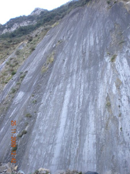
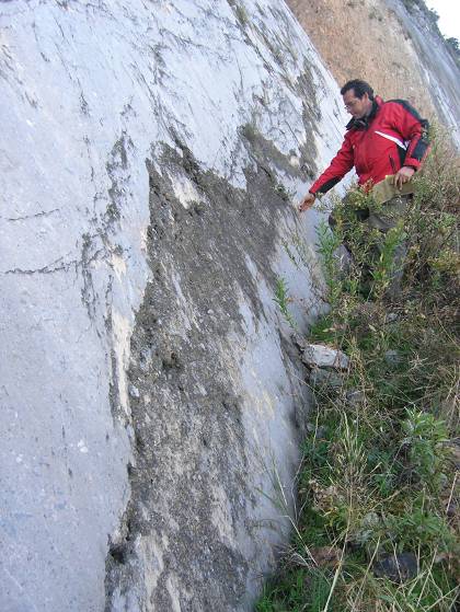
Greece is a country with high seismicity rates. As a consequence evidences of faulting are spread throughout the country. In this blog a particular fault mirror has come into our notice in central Greece, Fthiotida area, known as Arkitsa fault. This spectacular fault mirror is a subvertical feature 65m tall and about 300m long. The Arkitsa fault mirror is located in an area adjacent to the famous historic Thermopylae pass (Hot Gates), which is characterized of normal tectonic features and geothermal springs known since antiquity.
 The Arkitsa fault is considered by geologists to be active even though its historic activity has not been recorded. For this reason the Department of Geology of University of Patras (Greece), with Prof. Sotiris Kokkalas in charge, in cooperation with Durham University (UK), has initiated a study of the fault mirror of Arkitsa based on LiDAR technology. The purpose of this study is to provide a detailed geometric survey of Arkitsa fault so as to predict the magnitude of a future earthquake.
In addition a palaeoseismology analysis has been performed in order to estimate the seismic activity of the fault for the last 10.000 – 20.000 years. The analysis included collection of clay samples from the fault zone. Modern methods were used such as radiocarbon dating, scanning electron microscope and X-ray microanalysis. The palaeoseismological data indicate that Arkitsa fault has given at least four significant earthquakes the last 20.000 years. It is estimated that the last one was around 1300 – 1110 BC. In addition archaeological relics of destruction in an adjacent ancient settlement, as well as radiocarbon dating in tsunami deposits, possibly indicate this last activation of Arkitsa fault.
 It is considered that the time span of significant magnitude earthquakes of Arkitsa fault is large i.e. every 3.000 to 5.000 years. As a consequence since the last one was almost 3.000 years past, nowadays we are going through a period of time likely to give a seismic reactivation of the fault. Even though the wider area is deformed slowly (1-3 mm/year), Arkitsa rupture together with the adjacent Atalanta fault, are considered to be active.
Studying the Arkitsa rupture, scientists have decreed that in case the fault is reactivated, the maximum earthquake magnitude will be 5.9 to 6.2. It should be noted that this particular fault mirror presents a complexity that deviates from planar geometry.
This study is still in progress and its results are expected with interest. Hopefully similar studies will contribute in future to the scientific area of earthquake prediction, since this matter concerns a large number of humans around the world.
Source: http://www.enet.gr/?i=news.el.episthmh-texnologia&id=371724
")